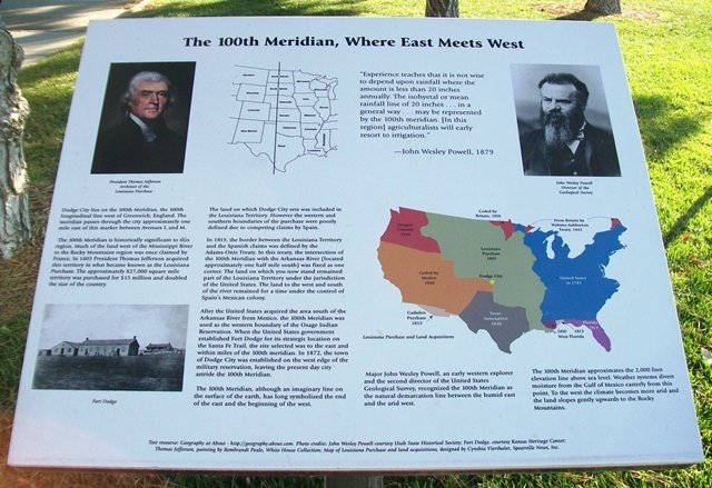
Historical Marker: The 100th Meridian, Where East Meets West
Introduction
Text-to-speech Audio

Images
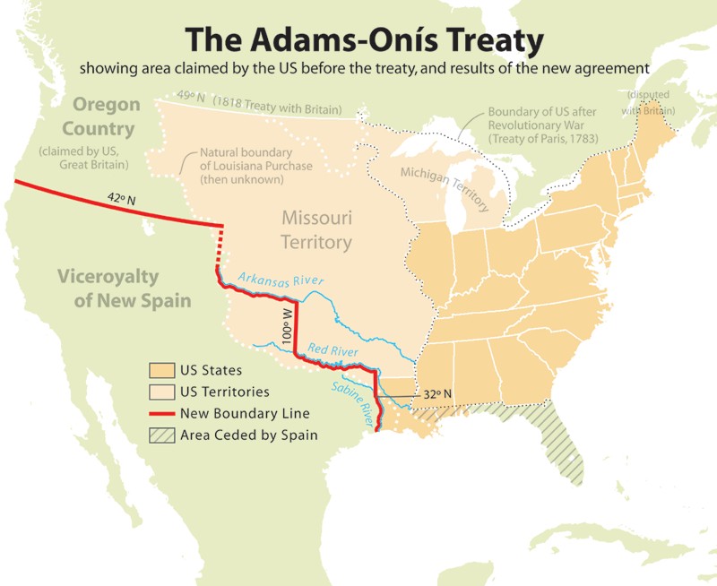
In 1819, Spain and the United States signed Adams-Onís Treaty, which defined the border between America and New Spain.
The historical marker provides an overview of the 100th Meridian Line.
Backstory and Context
Text-to-speech Audio
When the U.S. bought the Louisiana Purchase from France in 1803, the land on which Dodge City would be founded was part of the territory. The southern and western boundaries of the newly acquired territory were not clearly established, however. The issue was not settled until 1819 when Spain and the U.S. signed the Adams-Onis Treaty (1819). They agreed that one corner of the boundary was where the 100th meridian intersected with the Arkansas River, which is located 1.5 miles to the south of the marker. Later, the 100th Meridian was the western boundary of the Osage Indian Reservation. The 100th Meridian also roughly denotes where the boundary is between the dry western half of the country with the wetter, eastern half.
Cite This Entry
M., Ben. "Historical Marker: The 100th Meridian, Where East Meets West." Clio: Your Guide to History. September 9, 2019. Accessed August 23, 2025. https://theclio.com/tour/961/6/reverse
Sources
"The 100th Meridian, Where East Meets West." The Historical Marker Database. Accessed September 9, 2019. https://www.hmdb.org/marker.asp?marker=65287.
Wikimedia Commons
The Historical Marker Database