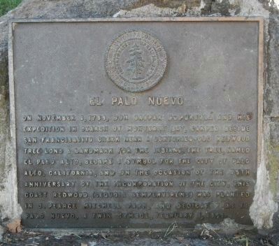
El Palo Nuevo
Introduction
Text-to-speech Audio
The redwood tree has long been a symbol for this section of California. Native inhabitants considered an extraordinarily tall redwood tree that had two separate trunks to be a landmark and meeting place. This same tree was identified by Don Gaspar De Portola and his men when they selected a place to camp during their 1789 expedition. The tree was later named El Palo Alto and became the symbol of the city. This historic marker does not denote the location of the great redwood tree where De Portola's men camped. Instead, it marks the planting of El Palo Nuevo in 1969. This tree was meant to be a symbolic brother of the of the one-thousand-year-old redwood El Palo Alto. For many years, residents feared that the 1000-year old tree might perish, but it continues to thrive thanks to the efforts of local citizens and the city. El Palo Alto can be found by clicking the link at the bottom of this page.
Images
This marker and tree can be found on the southern side of Mitchell Park.
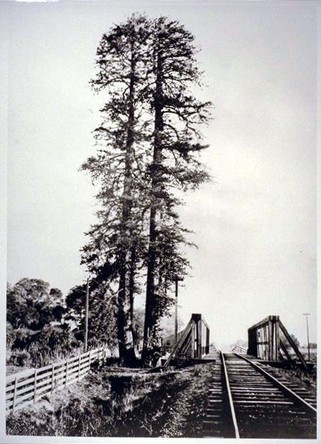
This photo of the two-trunked El Palo Alto was taken in 1875. The tree still stands at a park on the northern edge of the city.
Backstory and Context
Text-to-speech Audio
Gaspar De Portola was a soldier and explorer who became the first Spanish explorer in the San Francisco bay. He also served as the first Spanish colonial governor of Alta California. De Portola and his men encountered Native inhabitants during their time, an encounter that seems to have been peaceful at least from the perspective of the Spanish. Father Juan Crespi described the several thousand residents of the bay area as kind and generous. Part of the Costanoan tribes that thrived in the area, the inhabitants enjoyed a diet of shellfish, waterfowl, and fish. They also created large mounds that archaeologists have determined date back as far as 3500 years.
De Portola's mission to northern California had several purposes, namely to map and claim the area and establish a series of missions that would convert Native inhabitants to Catholicism. As the leader of the first land expedition to the area, he and his men created maps that named many of the geographic features.
De Portola's mission to northern California had several purposes, namely to map and claim the area and establish a series of missions that would convert Native inhabitants to Catholicism. As the leader of the first land expedition to the area, he and his men created maps that named many of the geographic features.
Sources
"El Palo Alto: Rooted in History," Palo Alto History.org (accessed 7/27/16) http://www.paloaltohistory.org/el-palo-alto.php
"The First Palo Altans" City of Palo Alto website, (accessed 7/27/16) http://www.cityofpaloalto.org/civicax/filebank/documents/10192