Fort Reno Park
Introduction
Text-to-speech Audio
Images
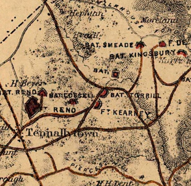
Close Up 1865 Map of the Fort Reno facility
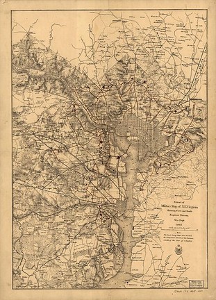
Circa 1860s Map of Washington Locations of the Fort Circle Defenses
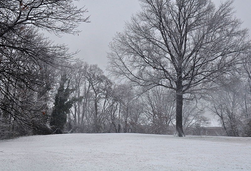
The Landmark is Located on the Ground just to the Left of this Tree. The Photgraph was taken Facing South. The Landmark is a small brass circular plaque on the ground.
Updated Map of Washington DC showing the location of the Fort.

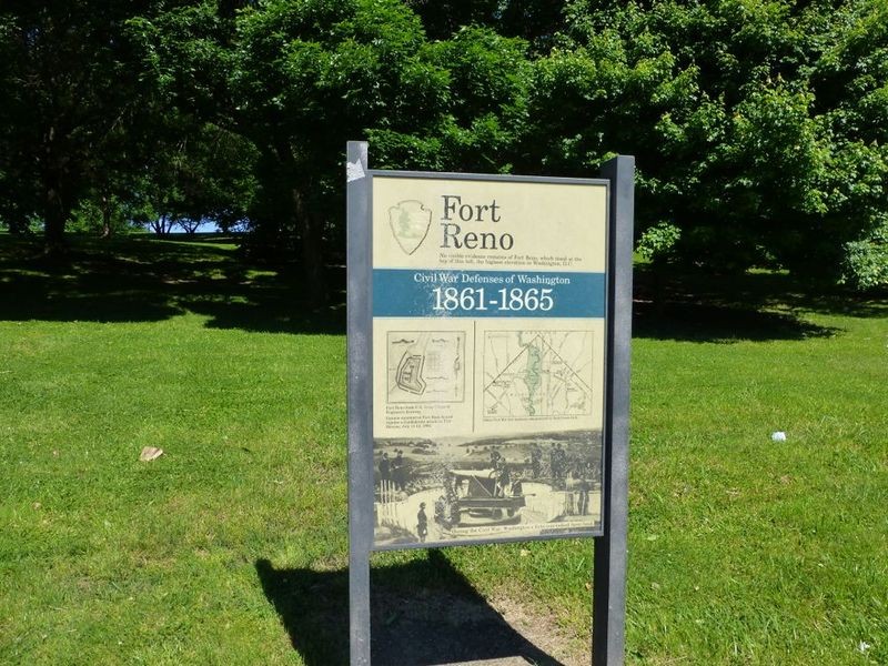
National Park Service marker.
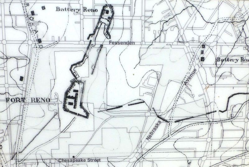
Map of For Reno.
Backstory and Context
Text-to-speech Audio
Fort Reno – Washington, DC
Fort Reno is one of the Fort Circle Parks – a name that was given to a group of Civil War defenses of Washington sites.[1] If you go to the highest point in Washington, DC, you can see a United States Geological Survey (USGS) Benchmark marker which denotes the original location of Fort Reno. Fort Reno was one of 68 forts that were built in a circle around the capitol city to provide military defenses. By 1865, the Defenses of Washington included 68 forts, supported by 93 detached batteries for field guns, 20 miles of rifle pits, and covered ways, wooden blockhouses at three key points, 32 miles of military roads, several stockaded bridgeheads, and four picket stations. Along the circumference of the 37-mile circle of fortifications were emplacements for a total of 1501 field and siege guns of which 807 guns and 98 mortars were in place. The defenseless city of 1860 had become one of the most heavily fortified cities of the world.
Fort Reno was involved in the only Civil War battle to take place in the District of Columbia. The highpoint was resurveyed and a new USGS Benchmark was placed in 2007 at coordinates N 38.95198 and W 77.075922, a location open to the general public. The new benchmark is not well marked and sits on a hill directly across from the main entrance of the Alice Deal Middle School. The Benchmark is located well outside the fenced area where the highpoint was previously believed to be. Fort Reno is now a city park in the Tenley Town neighborhood. The area known as Fort Reno is also home to Woodrow Wilson High School and the Alice Deal Middle School both part of the Washington DC public School system. Fort Reno originally had a benchmark height of 409 feet which is lower than the top of the Washington Monument (555 feet from sea level). However, the sandstone castle-like fort structures on top and highpoint antenna farm raise the height of Fort Reno above the Washington monument. The former Fort now is the highest point in Washington DC and the only structure to be higher than the Washington Monument.
Fort Reno was originally named Fort Pennsylvania, and was built during the winter of 1861 shortly after the disastrous defeat of the Union Army at the First Battle of Manassas. Brig. Gen. John G. Barnard, Col. of Engineers, U.S. Army was in charge of the civil war defenses around the city of Washington. Barnard chose the location of Fort Reno for its strategic importance in guarding the Rockville Pike (present day Wisconsin Avenue). Being the highest elevation in the city (429 feet above sea level), Fort Reno also served as a forward outpost and signal station for detecting enemy movement near the northern part of the city. The Fort was built by the 119th Pennsylvania Regimen. The name of the fort was changed to Fort Reno in 1863 in memory of Major General Jesse Lee Reno, who was mortally wounded at the Battle of South Mountain, September 14, 1862.
Fort Reno also became a home to thousands of freemen or freed African American former slaves in Washington DC. During the time of the Civil War the city of Washington was having a real estate and population boom of sorts. That trend continued after the war as well. Former slaves now free African Americans began pouring into the capital and since Fort Reno was no longer an active U.S. Army base, it became a little village and was known as Reno City. The small village located next to Tenley town in Washington housed about 1000 residents in cabins and small homes. Reno city also was home to the first African American Public School in the U.S. The Schoolhouse is under renovation today and is located just behind Alice Deal Middle School. The Schoolhouse is well preserved and can still be seen today.
Originally rather small, Fort Reno was enlarged and strengthened with an advanced battery 300 yards north from the highest ridge across what is now Fessenden Street and along 39th Street. This advanced battery had eight 12-pounder guns and a magazine; a covered walkway connected it to the main fort to the south. A double line of rifle trenches was added to strengthen the position. Eventually the fort was the largest and strongest of those defending the capital with a dozen heavy guns -- three Parrott siege guns and nine 27-pounder barbette guns. A force of three thousand men of the First Brigade made Fort Reno the stronghold of the northern defenses of the capital.
In July 1864, due to Gen. Ulysses S. Grant's request that troops be moved from the defenses to reinforce his army at Petersburg, Virginia, Fort Reno was under-manned, as were all of the defenses around the city. Hearing from spies that the capital was poorly defended, Confederate Gen. Robert E. Lee sent Gen. Jubal A. Early to attack from the north. Around noon Monday, July 11, 1864 (before the Battle of Fort Stevens), soldiers at Fort Reno were the first of the fortified defenses to view Gen. Early's advance near Rockville, Maryland. The lookouts from the signal tower at Fort Reno saw clouds of dust and then Confederate army wagons moving toward the city. During Early's assault of Fort Stevens on July 11th and 12th, 1864, the heavy guns of Fort Reno did not provide much military support, as there was a fear the long-range guns would hit the Union Army's advanced pickets. One of the shells that was fired from Fort Reno by a 100-pounder Parrott Rifle traveled 3 1/2 miles north of the fort, killing four Confederates where the present day Bethesda Naval Hospital is located in Bethesda, Maryland. Because Fort Stevens was reinforced on July 12, 1864, the Confederate army never took it, nor was the capital city ever reached.
During the fighting of July 10-12, 1864, small squadrons of soldiers from Forts Reno and Stevens had advanced into the countryside north of the city to fend off the invaders. A few Confederates were taken prisoner and brought back to camps where they were held until transfer to a central prison. Early's army retreated back across the Potomac River near Leesburg, Virginia, and the city of Washington escaped harm.
After the close of the war, all the forts that circled the city, including Fort Reno, were gradually dismantled. Most of Fort Reno could be seen as late as 1892, but the fort and battery at the north end were eventually graded down for the construction of a water reservoir. Today the former Fort is bounded by Nebraska Avenue, Fessenden Street, Belt Road, and Chesapeake Street, NW.
[1] The Civil War Defenses of Washington are the collective name of all sites that were part of the fortification network that defended Washington, D.C. during the Civil War.