District of Columbia South Cornerstone
Introduction
Text-to-speech Audio
Images
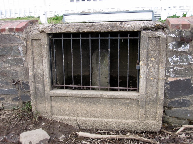
South Cornerstone. Image by Something Original on Wikimedia Commons (CC BY-SA 3.0)
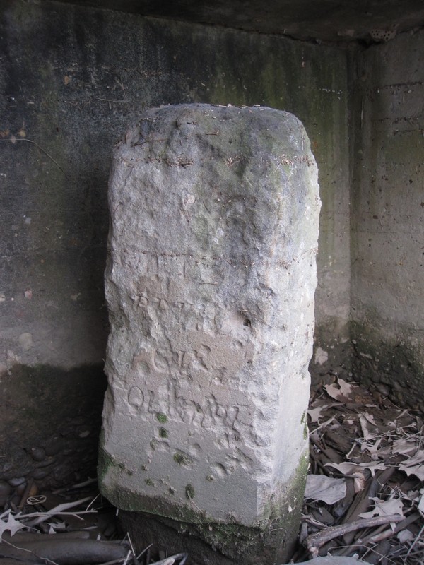
Closer view of the South Cornerstone. Image by Something Original on Wikimedia Commons (CC BY-SA 3.0)
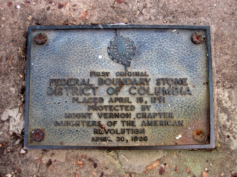
South Cornerstone plaque. Image by Something Original on Wikimedia Commons (CC BY-SA 3.0)
Backstory and Context
Text-to-speech Audio
On July 16, 1790 (amended March 3, 1791), the Residence Act granted President George Washington authorization to choose the site for a national capitol. It was to be a 100-square-mile plot located on the Potomac River, between the cities of Alexandria, Virginia and Williamsport, Maryland. Washington selected the southernmost location that encompassed what is now Old Town Alexandria and a busy port.
The territory chosen, Secretary of State Thomas Jefferson instructed Major Andrew Ellicott, a prominent surveyor, to begin demarcating the 10-mile square of the city limits. He began his work on February 11, 1791. Ellicott hired the Maryland astronomer Benjamin Banneker to provide the astronomical observations and calculations needed to fix the south corner. A free African American, Banneker was an experienced and largely-self taught, almanac, author, surveyor, naturalist and farmer. "Banneker fixed the position of the first stone by lying on his back to find the exact starting point for the survey ... and plotting six stars as they crossed his spot at a particular time of night."1
Banneker left Ellicott's team after the initial survey was completed. On April 15th, the achievement was commemorated by the Masonic Lodge in Alexandria. The Lodge placed a small, ceremonial stone at Jones Point at the south corner, although it was later replaced with a larger stone bearing the words, "The beginning of the Territory of Columbia." The rest of the inscription reads
May this stone long commemorate the goodness of God in those uncommon events which have given America a name among nations—
Under this stone may jealousy and selfishness be forever buried!
Commemoration of Cornerstone April 15, 17912
The inscriptions on this stone are now illegible.
The marker stones are made of Aquia Creek sandstone, weigh approximately half a ton (with the exception of the cornerstones, which are larger), and are separated by one-mile. Those placed more than a mile apart include an additional marking, indicating the extra distance. On each stone, facing D.C. territory, is the mile number and inscription "Jurisdiction of the United States." The opposite side features the name of the state the stone borders. The other faces state the magnetic variance of their location and the year the stone was placed.
Thirty-six of the marker stones are still in situ, or close to their original location, including the north, south, east, and west stones. The South Cornerstone is located within a seawall south of the Jones Point Lighthouse in Alexandria, Virginia. It borders the City of Alexandria, Virginia and Prince George's County, Maryland. This boundary marker was added to the National Register of Historic Places in 1980, along with the lighthouse.
Sources
1. "Boundary Stones of the District of Columbia." Boundarystones.org. Accessed October 1, 2016. www.boundarystones.org/. 2. "DC South Cornerstone - Alexandria, VA." Waymarking.com. Accessed October 1, 2016. http://www.waymarking.com/waymarks/WMN5QN_DC_South_Cornerstone_Alexandria_VA. "Benjamin Banneker." Wikipedia, the Free Encyclopedia. Accessed October 1, 2016. https://en.wikipedia.org/wiki/Benjamin_Banneker. "Boundary Markers of the Original District of Columbia." Wikipedia, the Free Encyclopedia. Accessed October 1, 2016. https://en.wikipedia.org/wiki/Boundary_Markers_of_the_Original_District_of_Columbia.
https://commons.wikimedia.org/w/index.php?curid=11322541
https://commons.wikimedia.org/w/index.php?curid=11322574
https://commons.wikimedia.org/w/index.php?curid=11322601