River Drive Logging Camps
Introduction
Text-to-speech Audio
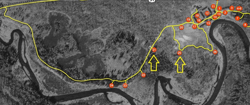
Two different river drive logging camps are located along the Camp Mercer Interpretive Trail. Logging camps are marked on the trail map as signs 21 and 25. The LaPorte logging camp is located at sign 21. The LaPortes were among the earliest pioneers and noted for their logging expertise. Louie LaPorte lived in the cabin after the logging job was completed in 1911. The logging camp located at number 25 has no sign because scholars are still debating the status of the camp. The camp located by number 25 is on a trail loop and very easy to identify. Sadly, some of the cabin structure and most of the blacksmith shop have been looted by modern treasure hunters. It is illegal to dig or take artifacts from public lands without a permit. Camp Mercer and other cultural sites like the logging camps are even more protected because they are recorded on the Wisconsin Archaeological Site Inventory. Observing, taking photos and sharing stories around the logging camps are encouraged.
The logging camps are on public land and can be accessed by river or by the bike trail and the Manitowish River Access Road. Following the markers on the Camp Mercer Trail maps is the most efficient way to get to these sites.
Images
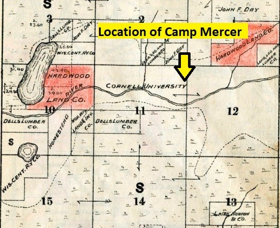
Plat Map of Cornell lands
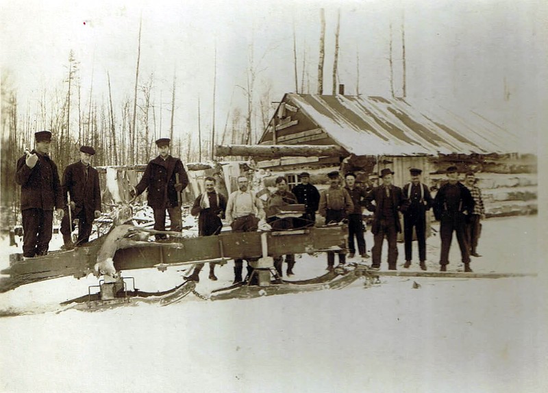
LaPorte Logging Camp
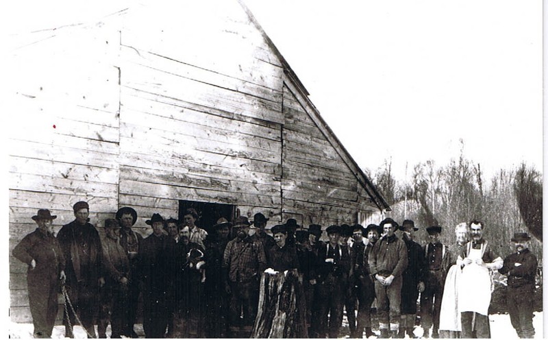
LaPorte Logging Camp and Crew
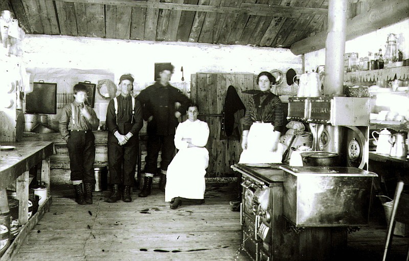
LaPorte Logging camp kitchen
Yellow arrows illustrate the location of each logging camp
Backstory and Context
Text-to-speech Audio
Earlier river drive era logging camps are also present on the Camp Mercer trail. Michael Dunn, Manitowish Waters’ historian, documented, “George LaPorte and his dad logged in 1910-1911 as contractors on 3 forties-- camp where CCC camp was in the 1930. They put the logs into the river, boomed them to Manitowish, loaded them on rail cars to go to Scott & Howe, Ironwood.” Berms along the logging road west of the old baseball field corroborate the claims of Dunn and mark the site of the LaPorte camp. Members of the LaPorte family were ambitious itinerate loggers who had been in the area since the late 1880s. As river drive logging was coming to a close, the LaPortes settled near the Manitowish River. Dunn further reports that the next year, “George [LaPorte] in 1911-1912- logging -built camp 1 mile west of Manitowish in fall 1911.- one big building 50 feet long with root cellar at one end and a 16 foot addition at on end for sleeping quarters.” The LaPorte camp has an interpretive sign marked 21 that overlooks the main cabin.
The LaPorte's logging camp and log drive was the last on the Manitowish River, and it was much shorter than the earlier log drives that pushed logs 200 miles or more to large mills near Chippewa Falls, Eau Claire and even as far as the Mississippi River. The earlier logging camp marked as 25 on the trail map would have operated around 1880-1901. The blacksmith shop and small cabin suggest a smaller logging crew and operation. This logging group would have operated in the winter, felling timber in the woods, skidding logs with horses or oxen to deck logs along the banks of the Manitowish River, and waiting for April when the Rest Lake Dam released its water.
Research revealed the land for Camp Mercer and the two logging camps were purchased by Cornell University under the Morrill Land Grant Act of 1862. Interesting, railroad land grant property is also noted on the plat map just a mile down river from Camp Mercer and the logging camps. Cornell University acquired 499,000 acres of Wisconsin pine lands on the Chippewa River and its tributaries, like the Manitowish River. Railroads acquired even more land in Wisconsin than universities to offset their construction costs. In Wisconsin, UW Madison, UW River Falls and UW Platteville were land grant colleges promoting agri-sciences.
Sources
Dunn, Michael, Unpublished histories. held by the Manitowish Waters Historical Society.
Ried, Daniel. Map of Iron County, Wisconsin T. 42 N, R. 4 E, Wisconsin Historical Society. 1898. Accessed December 8th, 2022. https://content.wisconsinhistory.org/digital/collection/maps/id/19980/rec/1.
Ried, Daniel. Map of Iron County, Wisconsin T. 42 N, R. 4 E, Wisconsin Historical Society. 1898. Accessed December 8th, 2022. https://content.wisconsinhistory.org/digital/collection/maps/id/19980/rec/1.
Manitowish Waters Historical Society
Manitowish Waters Historical Society
Manitowish Waters Historical Society
Manitowish Waters Historical Society