Starlight to Satellite: Navigation and Communication - Florida Maritime Museum
Introduction
Text-to-speech Audio

Images
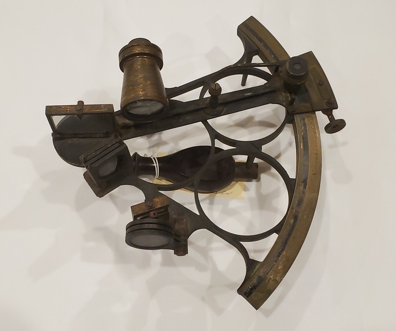
A sextant is a navigational tool that is used to pinpoint a ship’s location. It measures the angle from the horizon to the sun, moon, or a star. That information, along with the time of day, can be referenced in published tables to determine a ship’s latitude. The sextant is so named because its arc spans 60 degrees, or one sixth of a circle.
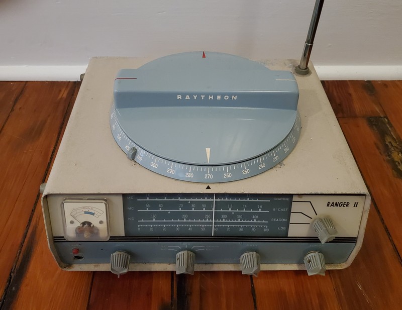
The radio direction finder (RDF) is a device that detects radio signals from broadcast stations on shore. With multiple signals, a ship can triangulate its position.
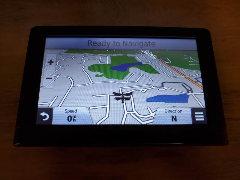
Global positioning system (GPS) is modern method of navigation that relies on satellites in space. Over 30 satellites send out signals to a receive, like a phone or car. The receiver calculates its distance from a satellite. Once it has these calculations from at least four satellites, it can identify its location to within a few yards.
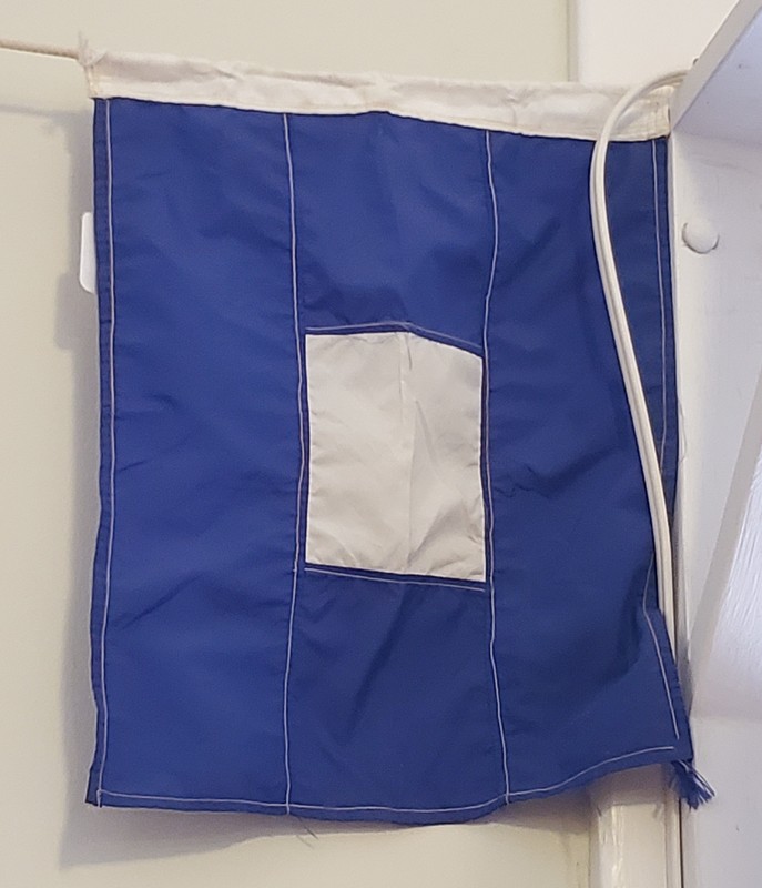
Signal flags are used on boats to convey visual messages to other boats. Each flag design corresponds to a letter of the NATO phonetic alphabet as well as a specific message. This flag refers to “Papa” in the phonetic alphabet (letter P) and can be used to indicate that all personnel should return to the ship.
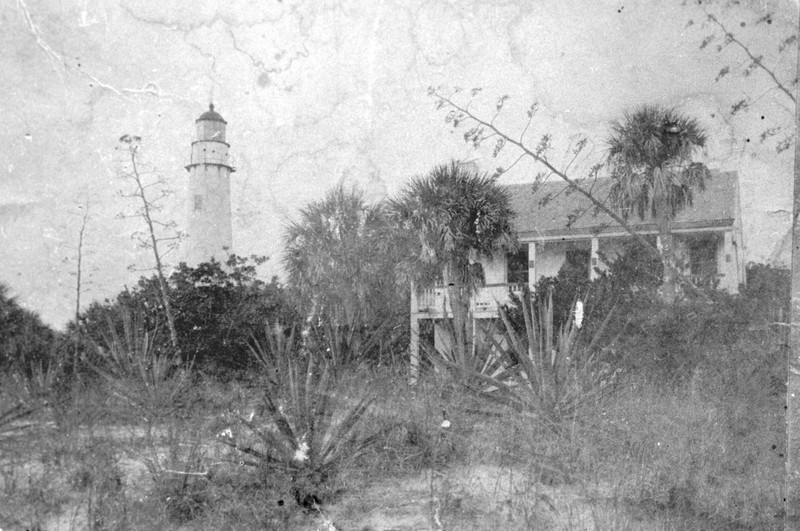
Egmont Key Lighthouse and keeper’s house (ca. 1900-1910). Lighthouse keepers and their families lived close to their work in order to keep the light operating in all kinds of weather.
The lighthouse keepers of Egmont Key pose with the light lens (1980)

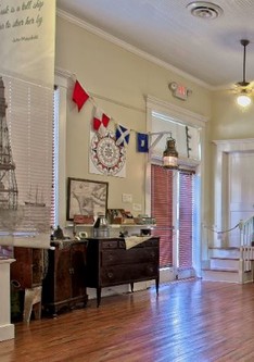
Exhibit featuring navigation and communication tools at the Florida Maritime Museum
Backstory and Context
Author-Uploaded Audio
00:00 / 00:00
Story of Egmont Key Lighthouse - Jennie LaForge, Registrar and Collections Specialist at FMM
Text-to-speech Audio
“Navigation is the art and science of determining the position of a ship, plane or other vehicle, and guiding it to a specific destination.”
Early sailors had no reliable means of navigation. They were guided by landmarks, shorelines, flora and fauna, as well as the sun and stars. For deep sea voyages, sailors would use dead reckoning, which estimated a ship’s position based on its last known position, its speed, and its direction.
Tools such as the astrolabe and sextant were developed to allow for more precise navigation at sea. These worked by finding angles between the horizon and the sun or stars to determine latitude. Finding longitude also required an accurate clock, so that time of day could factor into the calculation. Later, the advents of radio and satellites allowed for navigation using radio direction finders (RDF) and global positioning systems (GPS).
In addition to navigational tools used on board, sailors relied on external aids such as lighthouses and signaling devices. Lighthouses were used as a means guide ships safely through hazards or rough weather utilizing light or a radio signal. Signaling methods between ships were revolutionized with the invention of radio in the early 20th century. Prior to that, mariners used systems of lights, sounds, and flags to communicate.
Today, electronic systems and satellites have all but made these methods of navigation and communication obsolete. Despite that, many older methods are still employed as a measure of redundancy and safety for those who sail.
Cite This Entry
Admin, Clio, Jennie LaForge on behalf of Florida Maritime Museum, and Kristin Sweeting. "Starlight to Satellite: Navigation and Communication - Florida Maritime Museum." Clio: Your Guide to History. May 18, 2020. Accessed August 15, 2025. https://theclio.com/entry/103506/tour/5
Sources
Navigation, National Geographic. January 21st 2011. Accessed May 14th 2020. https://www.nationalgeographic.org/encyclopedia/navigation/.
Navigating at Sea, Time and Navigation - Smithsonian. Accessed May 14th 2020. https://timeandnavigation.si.edu/navigating-at-sea.
Clingan, Ian C. Lighthouse, Britannica. Accessed May 14th 2020. https://www.britannica.com/technology/lighthouse.
Light and Sound Signalling, ShipInsight. October 11th 2019. Accessed May 14th 2020. https://shipinsight.com/guides/light-and-sound-signalling.
Egmont Key Lighthouse, Lighthouse Friends. Accessed May 14th 2020. https://www.lighthousefriends.com/light.asp?ID=370.
Egmont Key State Park: History, Florida State Parks. Accessed May 14th 2020. https://www.floridastateparks.org/parks-and-trails/egmont-key-state-park/history.
Florida Maritime Museum Collection
Florida Maritime Museum Collection
Jennie LaForge
Florida Maritime Museum Collection
Manatee County Public Library
Manatee County Public Library
Florida Maritime Museum