UCV Civil War Military Operations Marker #19: Engagements at Cooke's Hill, May & September 1862
Introduction
Text-to-speech Audio
Images
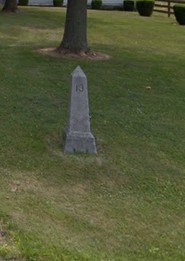
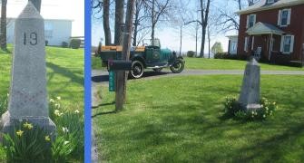
Obelisk #19
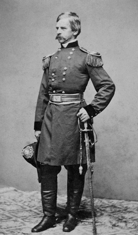
Union General Nathaniel Banks
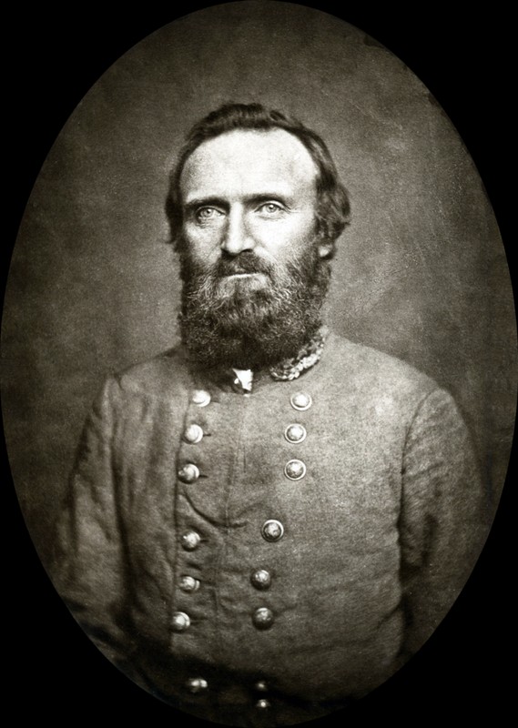
Confederate General Thomas "Stonewall" Jackson
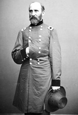
Union Brig. Gen. Rufus Saxton
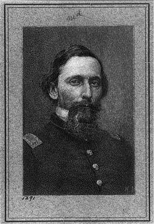
Confederate General Charles S. Winder
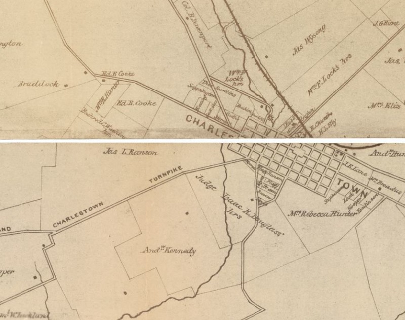
1862 map showing location of Cooke property outside of Charles Town
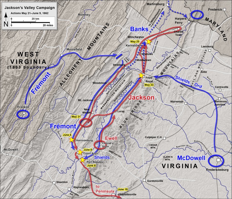
Jackson's 1862 Valley Campaign (map by Hal Jespersen)
Backstory and Context
Text-to-speech Audio
May 1862:
In spring of 1862, Confederate Major General Thomas J. “Stonewall” Jackson maneuvered his forces in the Shenandoah River to protect the supply lines of the Confederacy and draw Union troops away from eastern Virginia where Union General George B. McClellan was orchestrating the Peninsula Campaign against Richmond. In April 1862 Jackson lured the Union force under General Nathaniel Banks up the Shenandoah Valley (up = south), making Banks stretch out his supply lines and troops with detachments in different places. Then on May 19 Jackson turned his force around and started back down the Valley on the other side of the Massanutten Mountains, using the mountains to screen his movement from Banks. He pushed his troops quickly north with the intention to cut off the Union supply lines and drive Banks out of Virginia.
On May 23, 1862 Confederate cavalry cut the Manassas Gap Railroad and Jackson attacked Union troops at Fort Royal, forcing their retreat towards Winchester and successfully breaking the Union supply line. With the defeat at Front Royal, Banks retreated from his position at Strasburg on May 24 and also headed towards Winchester. Confederate cavalry hounded his retreat and attacked the Union wagon train, but Banks was able to reach Winchester first. On May 25, 1862 Banks tried to hold Winchester but was unsuccessful against Jackson’s attack and retreated towards Martinsburg, losing a substantial number of men and supplies.
Jackson’s push down the Valley concerned Lincoln and Secretary of War Stanton; they feared that Jackson would take Harpers Ferry and move north into Maryland to threaten Washington, D. C. or other northern locations. Lincoln and Stanton quickly sent more troops to defend Harpers Ferry and Brigadier General Rufus Saxton arrived with the 78th New York, 109th Pennsylvania, and 111th Pennsylvania Infantry Regiments, 4 companies of the 5th New York Cavalry, and a naval battery of Dahlgren guns.
With Banks retreating towards Martinsburg and Jackson closely following, General Saxton sent the 109th and 111th Pennsylvania to Charles Town with support from the 5th New York Cavalry. Jackson sent Brigadier General Charles S. Winder with four regiments of infantry and 10 guns to Charles Town to clear the Union troops out. The forces met on Potato Hill outside of Charles Town on May 28, 1862 and in a short fight Winder’s force was able to push the Union troops through Charles Town and back to their defensive lines at Harpers Ferry. Winder tested the Federal position on Bolivar Heights, but Saxton had a strong defense set up there and instead Winder fell back to Charles Town where Jackson joined him later that evening.
While Jackson’s force did threaten Harpers Ferry for a few days, incoming intelligence and changing troop movements changed his plans and Jackson instead took his force back up the Valley.
September 1862:
In September 1862 Confederate General Robert E. Lee planned an invasion north into Maryland after his successes in Virginia. As part of his strategy, Lee ordered General “Stonewall” Jackson to leave the main force at Frederick, MD, capture Martinsburg, VA, and then move on to Harpers Ferry. Harpers Ferry was an important strategic location for the Union in protecting the routes north towards Washington, D.C., and it would greatly benefit the Confederacy to hold it as Lee moved north. As Jackson’s force was moving on Martinsburg, a small engagement occurred here outside Charles Town. Part of the 1st New York Cavalry was stationed at Charles Town to prevent Confederates taking the town and moving on Harpers Ferry. On September 13, 1862 Company B of the 12th Virginia Cavalry scouted near Charles Town, looking for ways to take control of the town, and they engaged with the 1st New York Cavalry. The Federal force realized their numbers were too small to counter the Virginians and they retreated to Halltown. The pursuing Confederate cavalry met up with Jackson’s force coming from Martinsburg. The battle to capture Harpers Ferry started shortly afterwards.
About the Monuments:
This series of monuments and accompanying tour pamphlet were part of an initiative from the Jefferson County Camp, United Confederate Veterans to commemorate the 50th anniversary of the Civil War. In 1910 Col. R. Preston Chew and the Jefferson County UCV raised the funds to place 25 concrete obelisks in Jefferson County to mark locations of engagement or other significant events. The following year the Camp published a pamphlet to accompany the obelisks and give more information about each location. This was Military Operations in Jefferson County, Virginia (Now West Virginia), 1861-1865 published in 1911. The pamphlet has been reprinted several times by the Henry Kyd Douglas Camp, No. 199 of the Sons of Confederate Veterans. Because the monuments and accompanying pamphlet were done by Confederate veterans it is likely that the locations and descriptions are biased towards or favor the Confederate view and experience of the war.
Original Text from the 1911 Pamphlet:
"Marker Number Nineteen
General Winder’s Repulse of Federals at Cooke’s Hill
After defeating Banks at Winchester, Winder with the Stonewall Brigade and some Artillery was ordered to Charles Town. The enemy had formed a line of battle on Potato Hill in Charles Town.
General Winder planted his artillery near Cooke’s house, and deploying his infantry commenced an attack at once. The enemy soon gave way and retreated in great confusion through the town.
The Market House and Railroad Station had been destroyed by the enemy the day before.
General Winder pursued to the vicinity of Harpers Ferry, but was ordered back on the 30th, and made his wonderful march to Strasburg.
On the 7th of September 1862, Baylor’s Company took a position near Charles Town on Cooke’s Hill, and remained there until the morning of the 13th.
The four companies of the First New York Cavalry attacked it, and a very sharp encounter took place in which Lieutenant Rouss and Cary Sheldon were wounded."
Sources
Bushong, Millard Kessler. A History of Jefferson County, West Virginia. Charles Town, WV: Jefferson Publishing Company, 1941.
Engle, Stephen Douglas. Thunder in the Hills: Military Operations in Jefferson County, West Virginia, During the American Civil War. Charleston, WV: Mountain State Press, 1989.
Hearn, Chester G. Six Years of Hell: Harpers Ferry During the Civil War. Baton Rouge: Louisiana State University Press, 1996.
Military Operations in Jefferson County Virginia (and West Va.) 1861-1865. Published by Authority of Jefferson County Camp U.C.V. Farmers Advocate Print, 1911. Accessed January 20, 2021. https://babel.hathitrust.org/cgi/pt?id=uc2.ark:/13960/t4vh5gp6c&view=1up&seq=5.
Google Maps. Accessed February 2, 2021.
"Nathaniel P. Banks." Wikipedia. Accessed February 3, 2021. https://en.wikipedia.org/wiki/Nathaniel_P._Banks.
"Stonewall Jackson." Wikipedia. Accessed February 3, 2021. https://en.wikipedia.org/wiki/Stonewall_Jackson.
"Rufus Saxton." Wikipedia. Accessed February 3, 2021. https://en.wikipedia.org/wiki/Rufus_Saxton.
"Charles Sidney Winder." Wikipedia. Accessed February 3, 2021. https://en.wikipedia.org/wiki/Charles_Sidney_Winder.
United States Topographical Bureau, and Samuel Howell Brown. Map of Jefferson County, Va. photographed for the Bureau of Topographical Engineers Oct. [S.l.: s.n., ?, 1862] Map. https://www.loc.gov/item/lva0000085/. Accessed February 3, 2021. https://www.loc.gov/resource/glva01.lva00085/?r=0.23,0.345,0.263,0.105,0.
"The First Battle of Winchester." Wikipedia. Accessed February 3, 2021. https://en.wikipedia.org/wiki/First_Battle_of_Winchester.