Stop 6: The Confederate Right Flank & the 45th Virginia
Introduction
Text-to-speech Audio
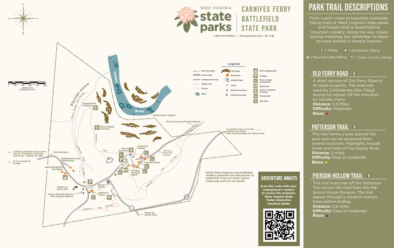
After Stop 5, continue back along the Pierson Hollow Trail until you reach the intersection with the Patterson Trail from earlier. Continue on the Patterson Trail by taking the branch to the left that continues uphill out of the ravine. Continue on the trail until you arrive at the stairs down to the Copperhead Overlook.
Images
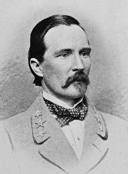
Colonel Henry Heth, 45th Virginia Infantry
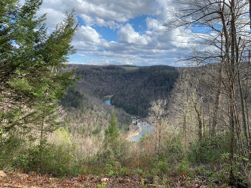
Copperhead Overlook--As you walk this section of the Patterson Trail, enjoy the three magnificent overlooks over the Gauley River.

Pillow Rapids Overlook
Interpretation near Picnic Overlook
View from the Picnic Overlook

Carnifex Ferry Battlefield State Park Trail Map
Backstory and Context
Text-to-speech Audio
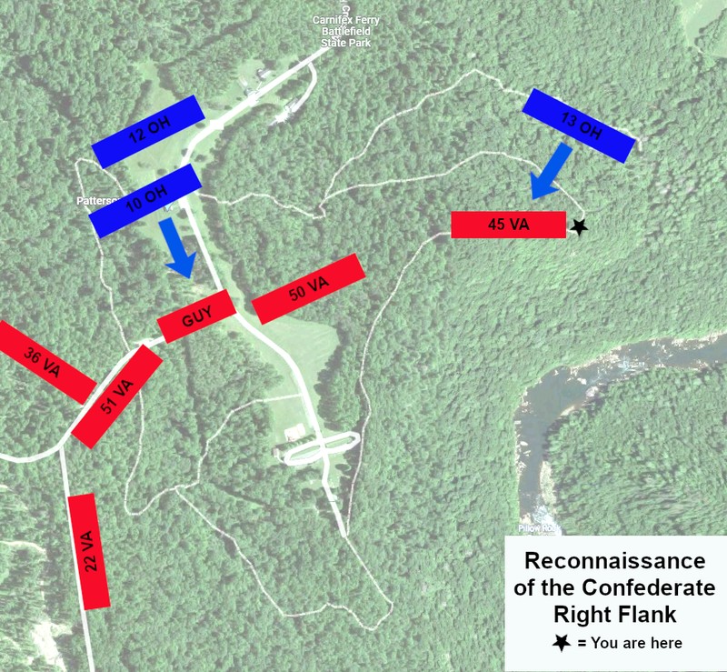
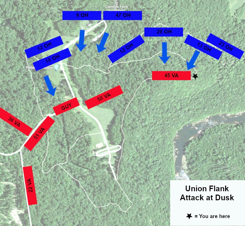
This position was the far right flank of the Confederate line, held by Colonel Henry Heth’s 45th Virginia. If you position yourself to face away from the stairs to the Copperhead Overlook, Pierson Hollow and the approach of the Union assaults is to your forward right and to your left was the rear of the Confederate works. In the afternoon of September 10th the 13th Ohio attacked this flank and temporarily pushed the 45th Virginia back towards the center of the Confederate line. This success led to Rosecrans’ plan to assault this flank again later in the evening. The 13th and 28th Ohio attacked as planned, but the assault was called off due to darkness and the Confederate flank held.
As you continue on the Patterson Trail you will be following the position of the 45th Virginia until you reach the intersection with the trail that leads to the softball field. The line of the 45th Virginia continued along that path until roughly the location of the softball field and then the position of the 50th Virginia turned to continue across the road to the main artillery redoubt. The Patterson Trail will diverge from the Confederate line and take you into the interior of what was Camp Gauley.
General Floyd was wounded within the first fifteen minutes of the fight. A musket ball passed through his right forearm, luckily missing the bone. He was brought to the rear where his arm was tended to and he returned to his front lines in about 10 minutes.
Sources
Lesser, W. Hunter. Rebels At the Gate: Lee and McClellan on the Front Line of a Nation Divided. Naperville, IL: Sourcebooks, Inc., 2004.
Lowry, Terry. September Blood: The Battle of Carnifex Ferry. Charleston, WV: Quarrier Press, 2011.
Shaffer, Dallas B. “The Battle at Carnifex Ferry.” State of West Virginia. Produced by the Department of Natural Resources, Division of Parks and Recreation. C. 1963.
Snell, Mark A. West Virginia and the Civil War: Mountaineers Are Always Free. Charleston, SC: The History Press, 2011.
Stutler, Boyd B. West Virginia in the Civil War. Charleston, WV: Education Foundation, Inc, 1966.
"Henry Heth." Wikipedia. Accessed May 28, 2022. https://en.wikipedia.org/wiki/Henry_Heth.
Base map from Google Maps. Edited by Kathleen Thompson.
Base map from Google Maps. Edited by Kathleen Thompson.
Photograph by Kathleen Thompson, April 7, 2022.
Photograph by Kathleen Thompson, April 7, 2022.
Photograph by Kathleen Thompson, April 7, 2022.
Photograph by Kathleen Thompson, April 7, 2022.
Carnifex Ferry Battlefield State Park. Accessed May 30, 2022. https://wvstateparks.com/wp-content/uploads/2020/09/CarnifexFerryBattlefieldStateParkMap.pdf.